The Full Picture, From Above.
Rural focused drone photography, providing practical images for farming, contractors, construction, forestry, utility insurance and council applications.
What we do
Provide clear, timestamped visual evidence of work progress or completion—such as fencing installation, track repairs, earthworks, construction, roof cleaning, or water-collection systems—using high-resolution photographs, annotated drone imagery, and short video clips that show before, during, and after conditions.
Work-in-Progress Reporting
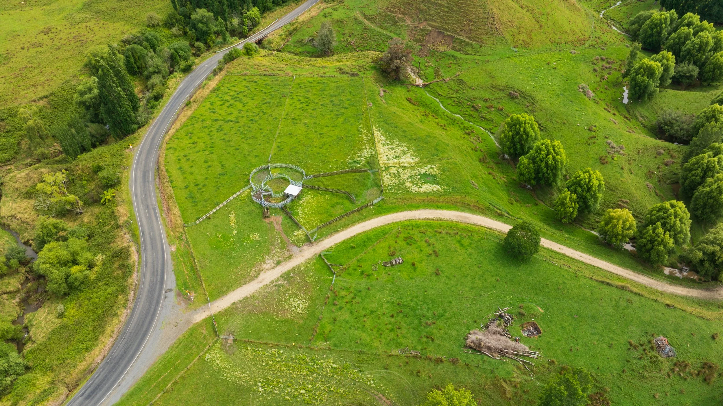
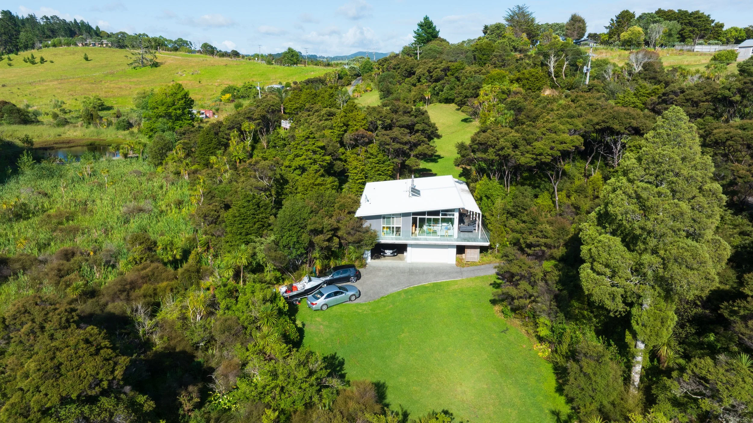
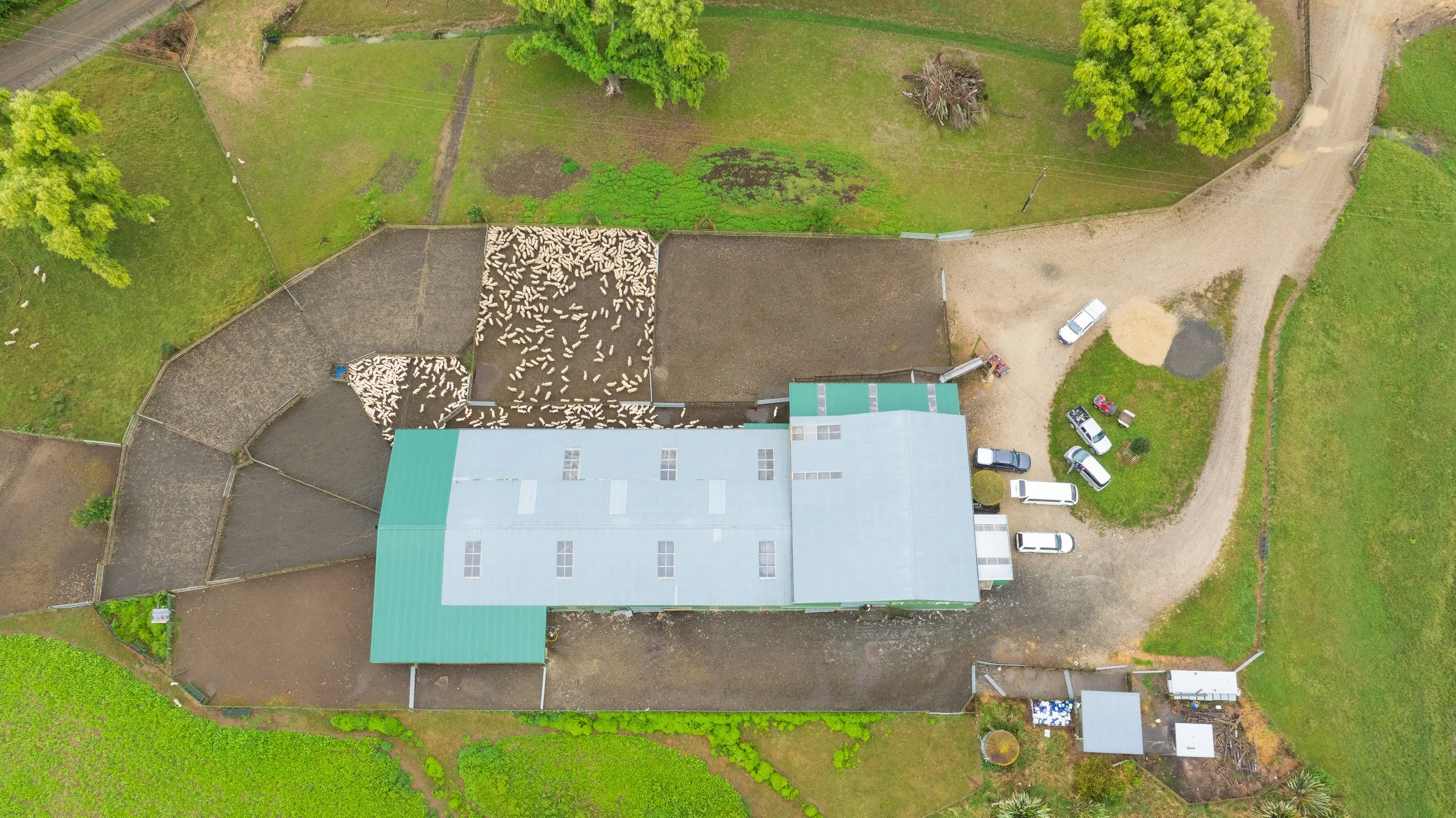
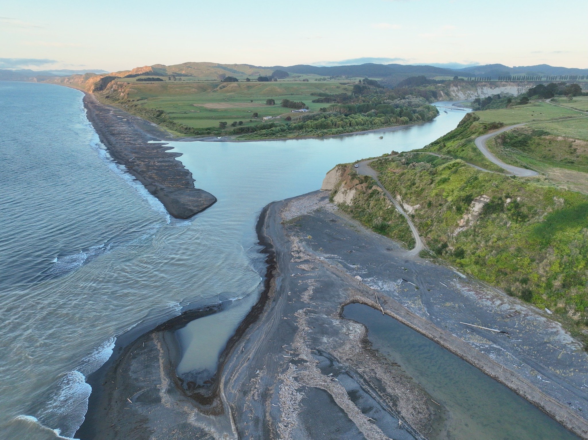
Document the current condition of rural infrastructure from above, carefully capturing roads, bridges, drainage systems, and utility lines to provide an accurate, up-to-date assessment. Include visible wear, blockages, encroachments, and any potential hazards for a clear operational overview.
Land Documentation
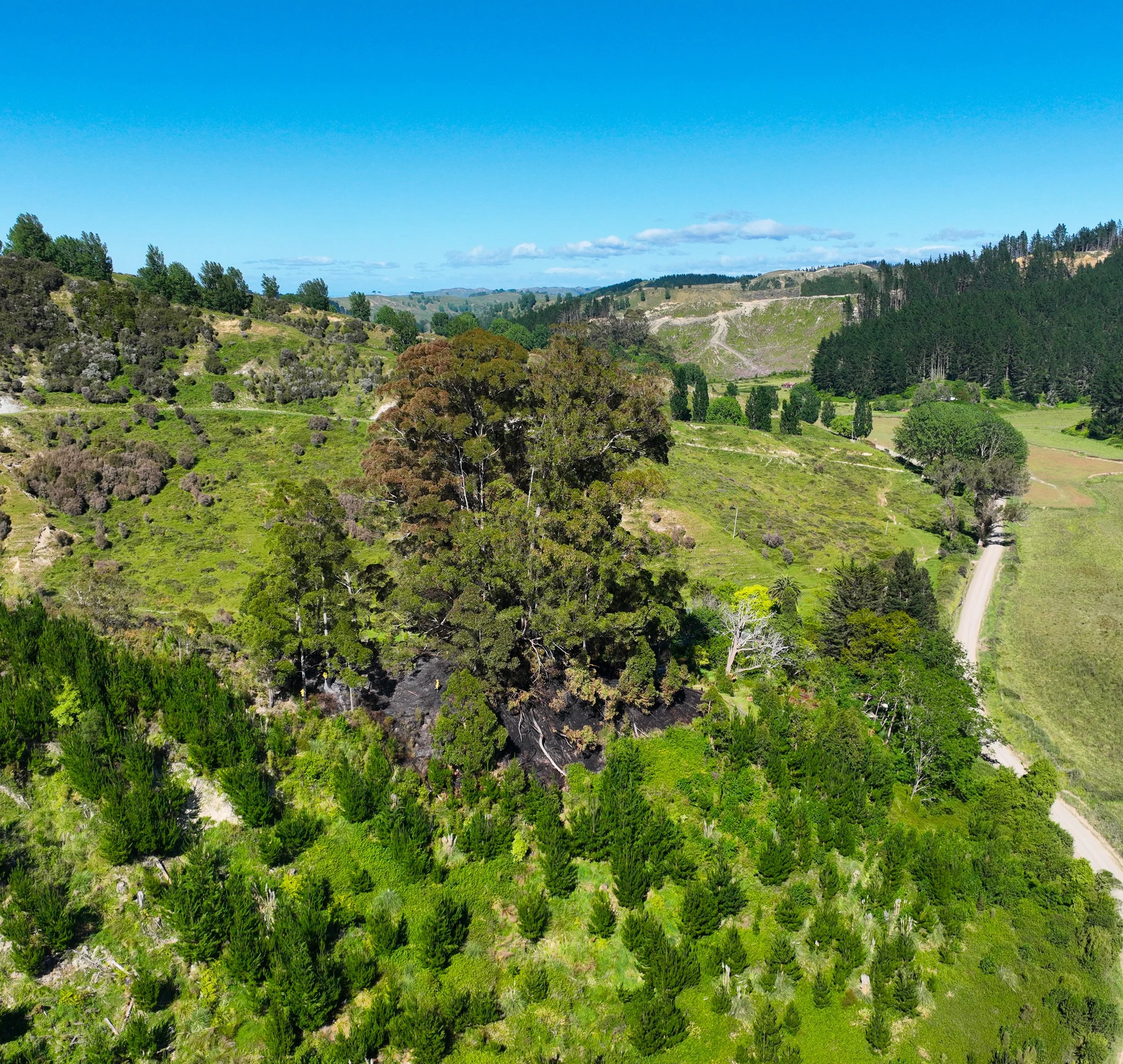
Substantiate areas of native bush, plantings, scrub clearing, spraying. Object areas can be reconciled with Google Earth to measure areas in hectares. If exact areas to cm level required, see Aerial Mapping section under Fee Structure. Provide proof of fire dams and fire breaks for insurance purposes.
Validation & Confirmation
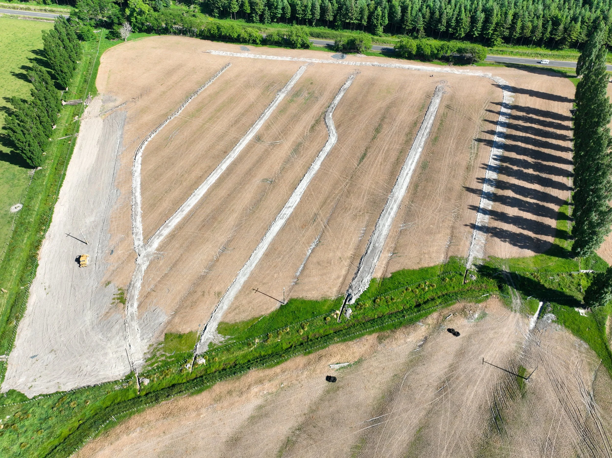
Accurate pre- and post-work mapping is vital for drainage, contouring, track building, dam work, and other earthworks. High-resolution aerial surveys give precise contours, volumes, and change detection, saving time and money, improving contractor accountability, and protecting long-term performance. For major ground works, professional mapping is the best way to reduce risk and prove the job was done right.
Site Mapping
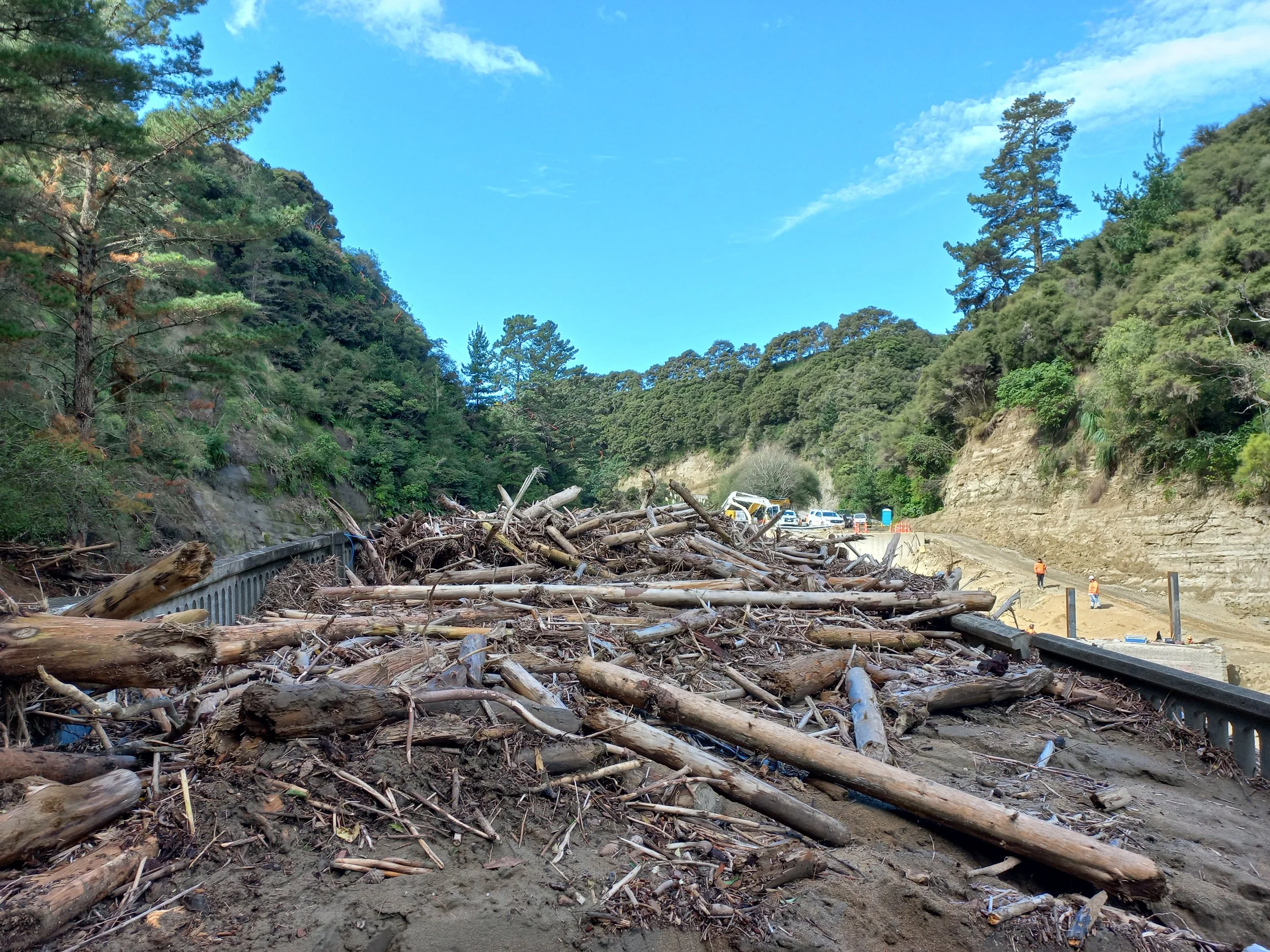
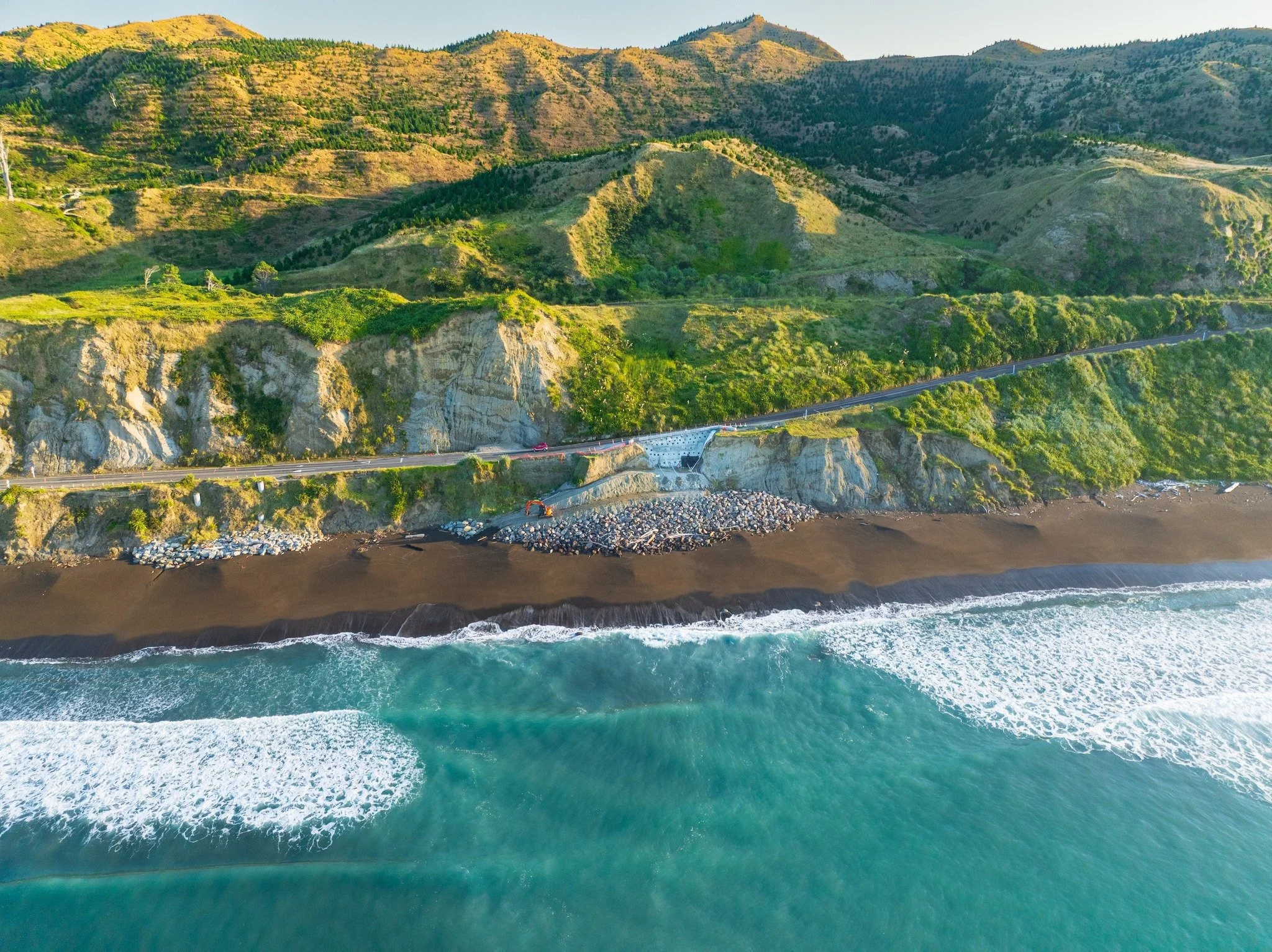
Aerial and on-site imagery provides clear, verifiable proof of damage to land and infrastructure — whether caused by flooding, slips (landslides), or wind — by capturing the extent, location, and progression of impact in high resolution formats enables rapid assessment of usability for transport corridors, utilities and buildings, supporting insurance claims, emergency response and repair planning with measurable evidence of change over time.
Damage Evaluation
Before installing or repairing equipment on structures—such as satellite dishes, solar panels, hot water panels, roof drainage, water collection systems, or stock troughs—conduct a thorough site assessment to confirm structural integrity, load capacity, and safe access points; verify that permits and utility locates are completed; plan for weather conditions, material staging, and waste containment.
Site Planning
Our Fee Structure
Hawkes Bay & Gisborne
$150+GST per hour, min charge per job $250 + GST. There is ½ hour of editing and production added, per hour of field work.
Examples of job prices:
To photograph the buildings, yards and dams on a fairly flat to rolling 500 acre farm would take about 2 hours if the owner guides us to the various objects = $450 + GST.
To photograph 30 acres of flat paddock after drainage would take about 1hr = $225 + GST. However we would invoice the min charge of $250 + GST.
Additional travel charges outside Hawkes Bay & Gisborne:
Taupo, Waikato, Bay of Plenty $150
Elsewhere in North Island $250
Aerial Mapping
We can produce 2D and 3D maps of terrain, slip progression, infrastructure, crops etc with GPS, elevation and distance data.
Multispectral mapping provides this data, plus further data in specific light frequencies, which is especially useful for cropping and orchards. This data can illustrate the health of plants and soil, or allow targeted spraying or fertilizer application on the areas that need it.
Pricing for aerial mapping is higher than standard photography, at $250 per hour. This reflects additional time required in editing and analysis, and the additional software and equipment required to perform mapping.
About
the company
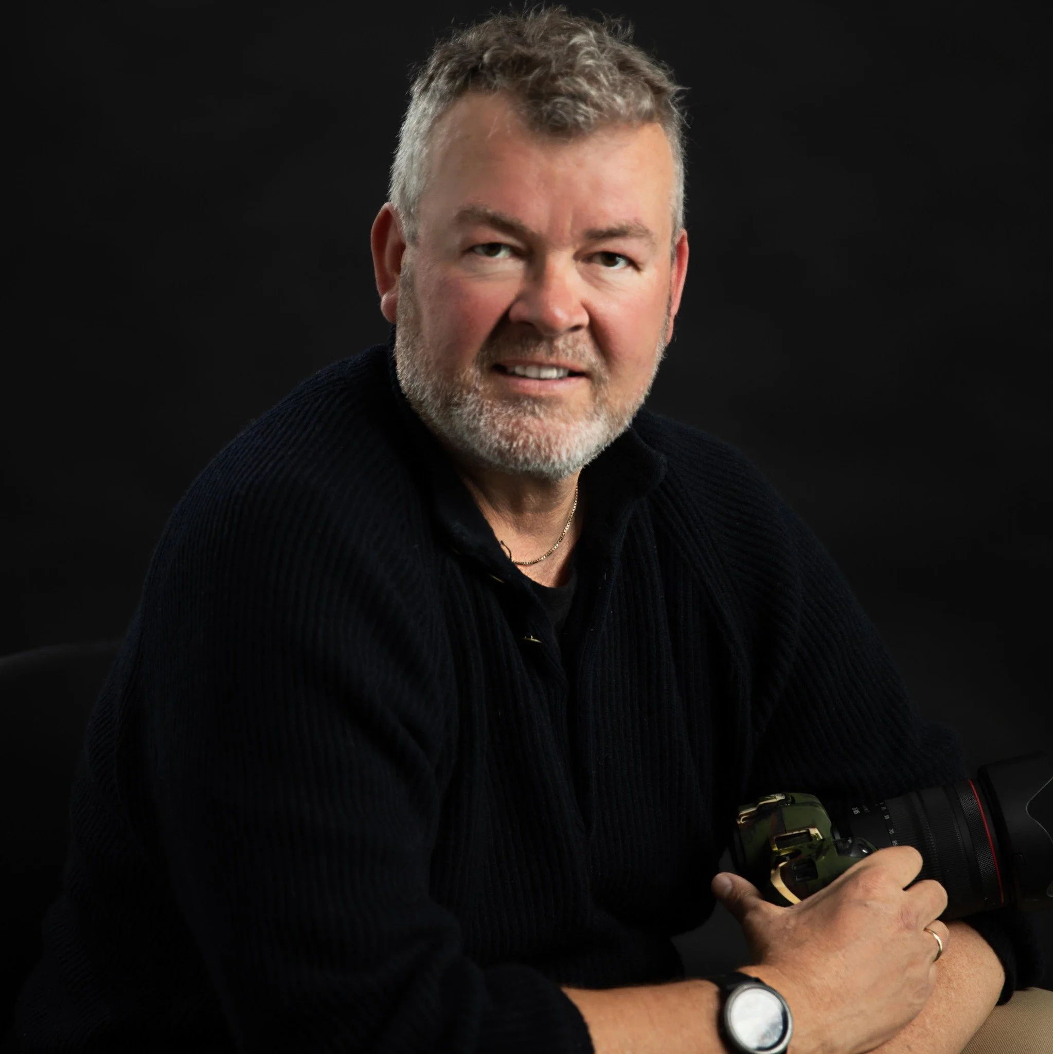
Dronemedia.nz is founded and operated by Craig Curphey, based in Wairoa, Hawkes Bay, and he has been operating drones since 2017. Craig is also is a videographer and still-life photographer.
We don't just fly drones - we take time to understand your needs, the goal and how we can help fulfil it.
Our business also includes Wairoa Garage Limited and Stihl Shop Wairoa with rural based automotive and small engine workshops.